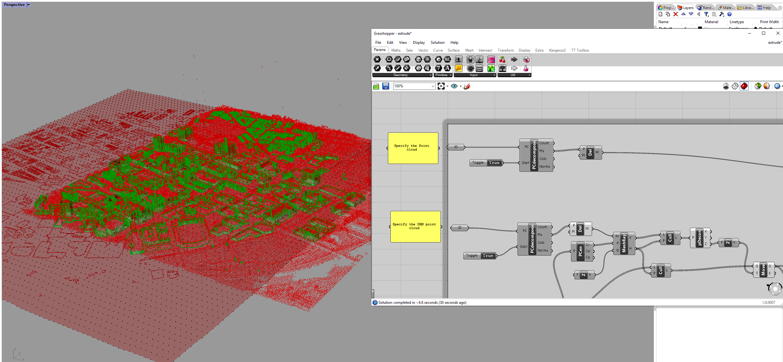
1.12. Extrude Building Footprint Based on DEM and LiDAR Point Cloud#
Import the DEM as XYZ file. Then type in the command “PointCloud” to turn the DEM points into point clouds. The processing will be faster (Import Raster Layer (DEM & Surface Temperature) into Rhino).
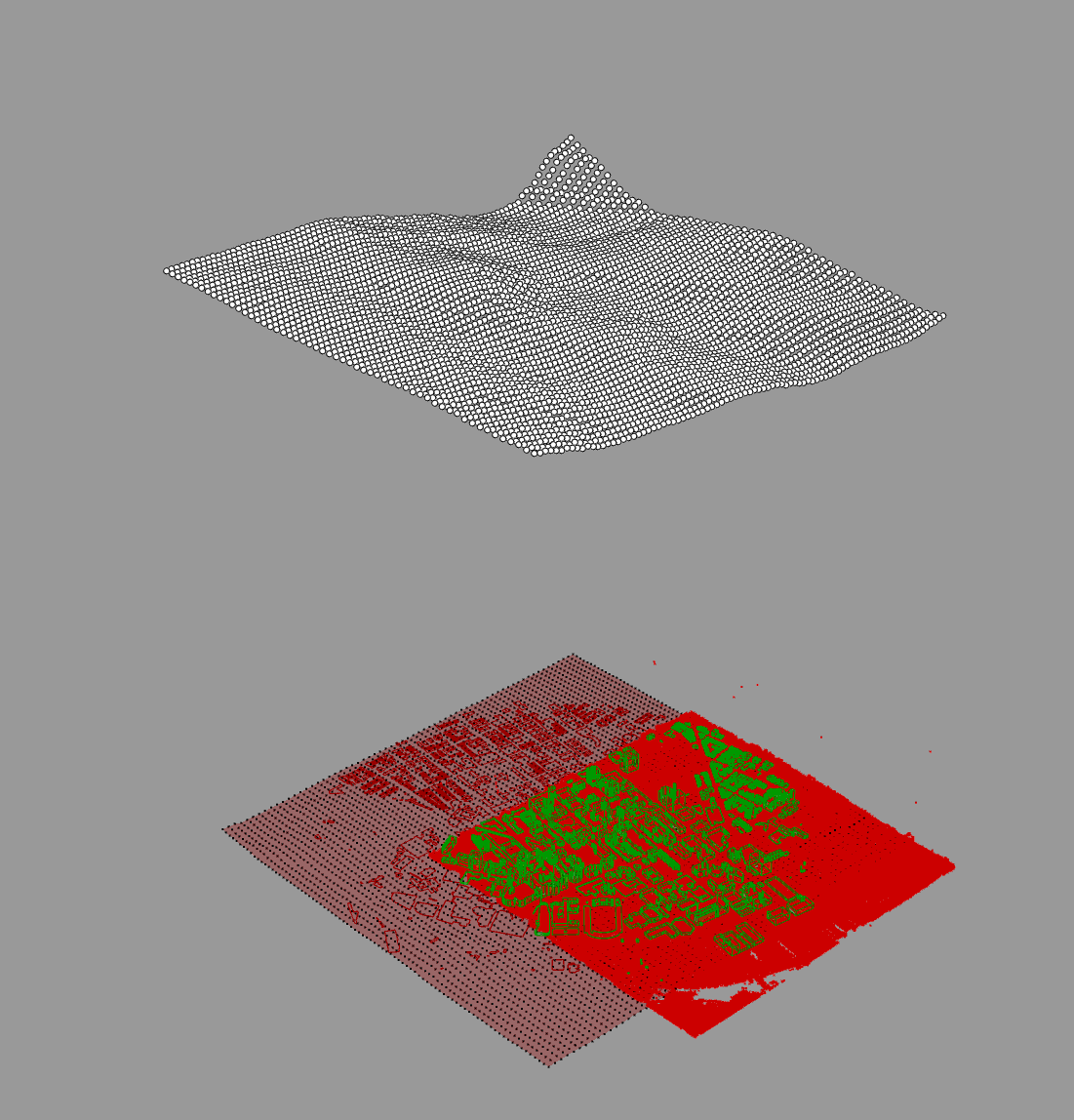
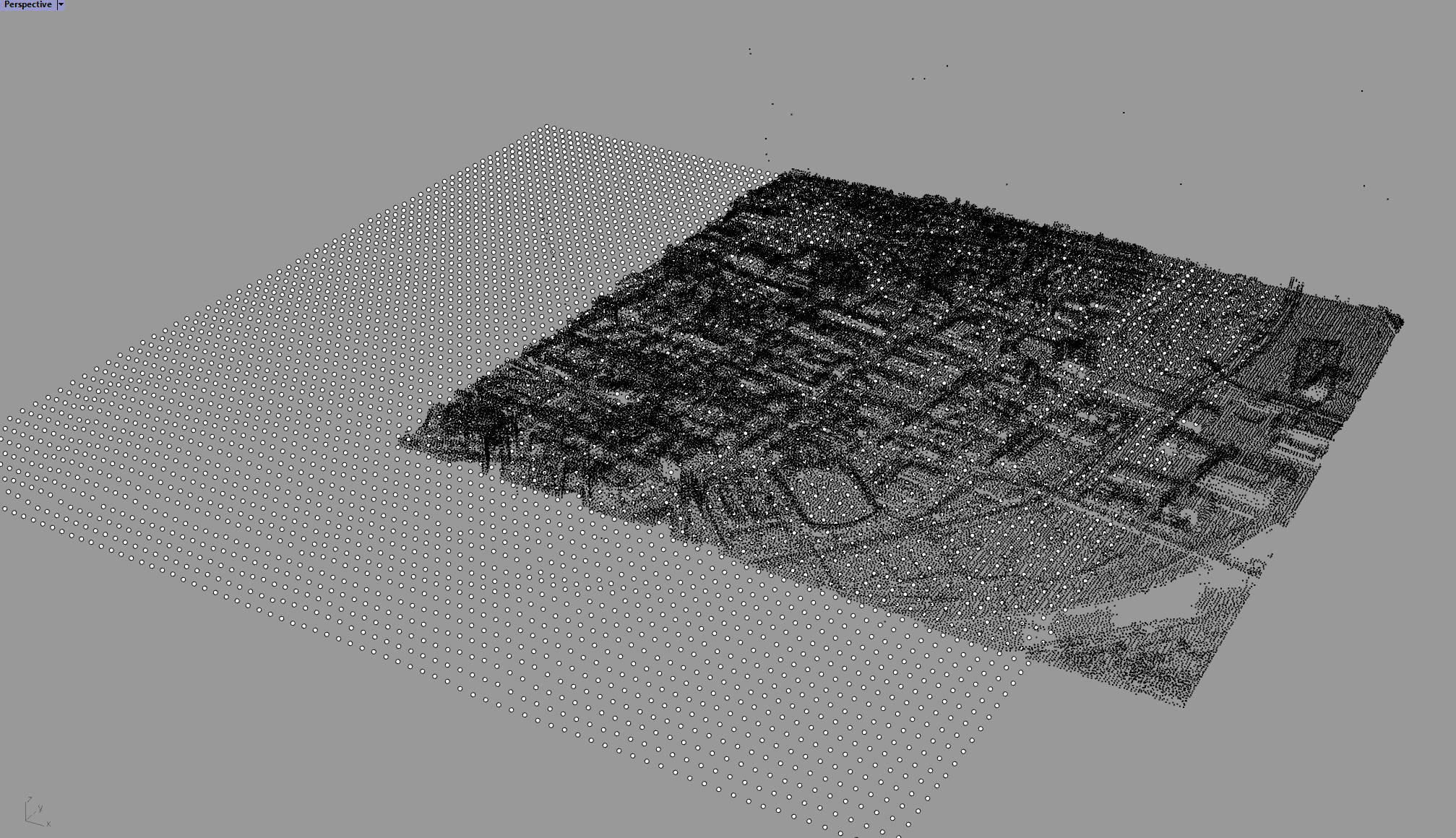
Import the LiDAR point cloud (Search for LiDAR information - Assuming the Building Footprint Data has no Height Information).
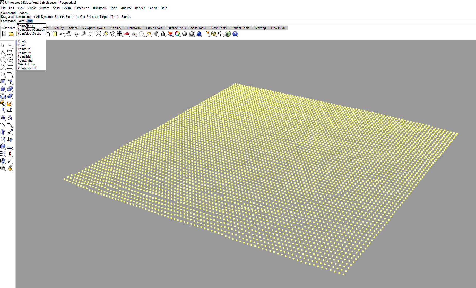
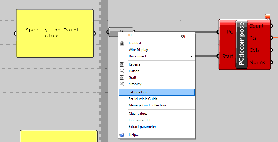
Install the PointCloudComponent (PCC) plugin from here here. Open Grasshopper and open the ”extrude.gh”. Specify the three inputs for the definition to work.
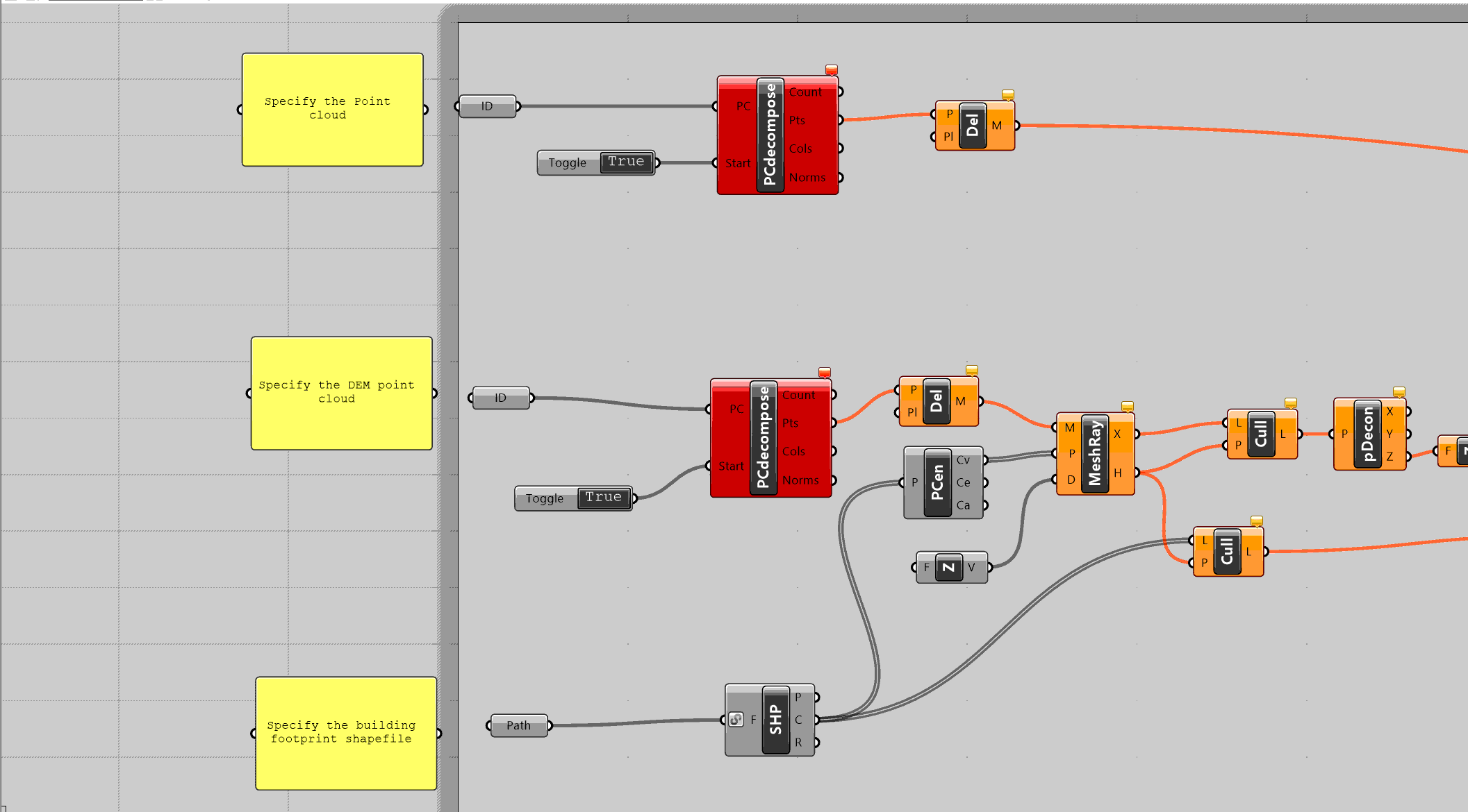
Right click on the first ID node. Then choose the LiDAR point cloud in Rhino window. Do it with the second ID node but with the DEM point cloud. Lastly, specify the building footprint shapefile (Import Vector (Shapefiles) into Rhino).
Turn the toggle to True. The building will be extruded.
You can import all the other data (both Vector and Raster) into Rhino and use it for your design.