3.3. Estimate Tree Heights with Impervious Surface Layer and LAS#
Create a grid layer with the following parameters. Save it as a permanent layer before performing the next step.
Grid type: Rectangle
Grid extent: "choose the buffer layer"
Horizontal spacing: 5 meters
Vertical spacing: 5 meters
Grid CRS: epsg 32111
Select the grids that did not intersect with the impervious surface layer.
First select the gird that is intersecting the impervious surface layer
Inverse the selection and you will get the result. Edit -> Select -> Invert Feature Selection
Download and install the gis3d plugin. https://github.com/chenkianwee/gis3d?tab=readme-ov-file#installation
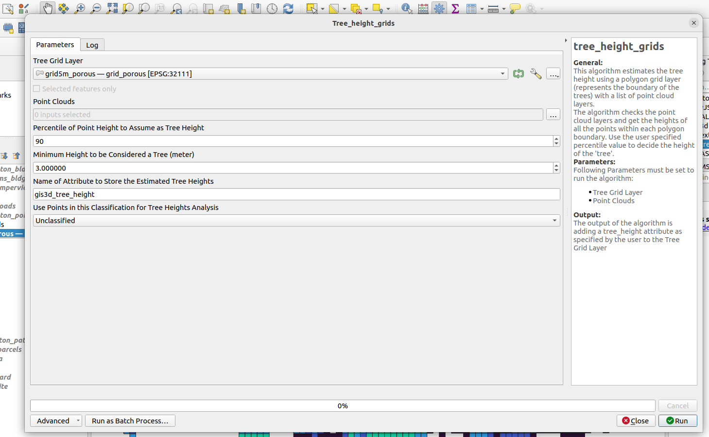
Once installed you should be able to find the gis3d plugin under Plugins -> gis3d -> tree_height_grids. Key in the parameters as follows:
Tree Grid Layer: 5m grid that was created in the previous step
Point Clouds: select all the point clouds that is loaded in the canvas
Percentile of Point Height to Assume as Tree Height: 90
Minimum Height to be considered a Tree (meter): 3.0
Name of Attribute to Store Estimated Tree Heights: gis3d_tree_height
Use Points in this Classification for Tree Heights Analysis: Unclassified
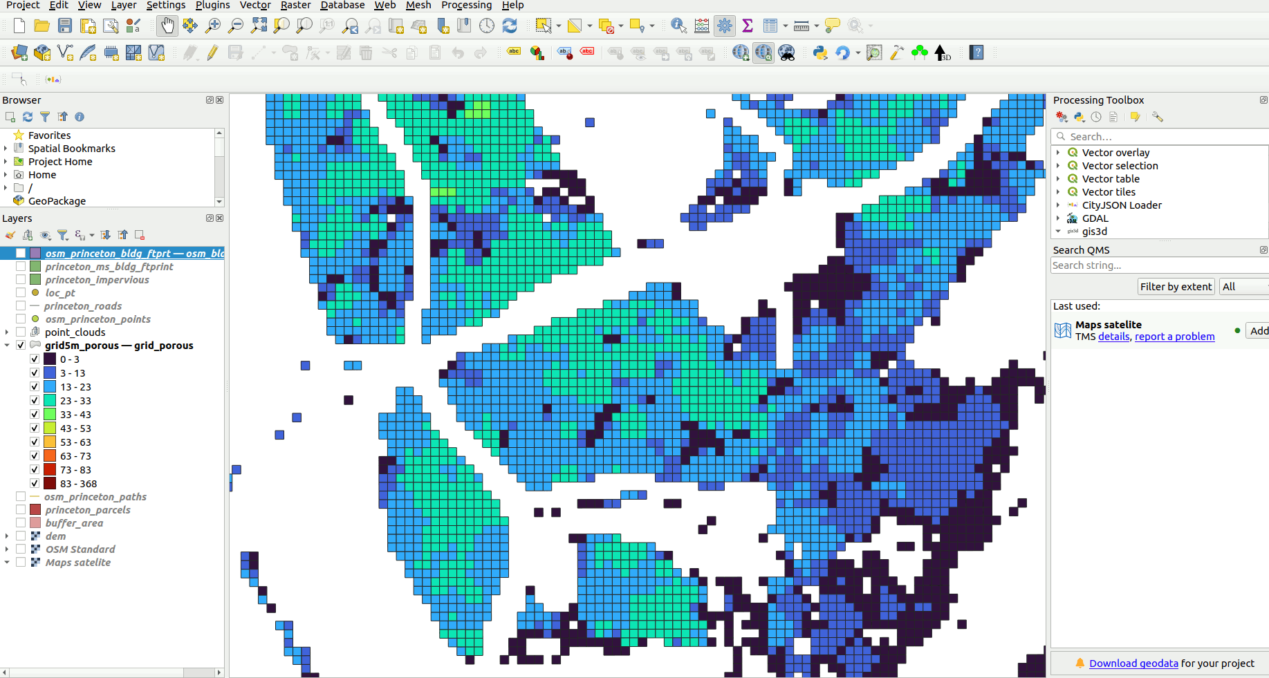
run the algorithm depending on your computer specification and the size of your data set. The processing time will differ. The result of the processing can be visualized in falsecolor as shown below.
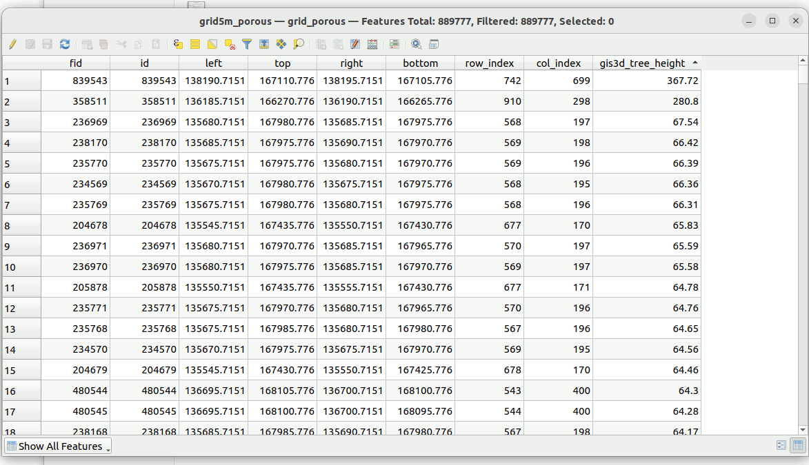
Once processing is done. The layer will have a new attribute appended to it.