28. Reprojecting Files#
In order to perform spatial analysis (intersection & unions) on the maps, we need to project it from Lat/Lon into metres. Refer to Understanding Coordinate Reference System/ Spatial Reference System used in GIS for explanation of Coordinate Reference System (CRS) and projections.
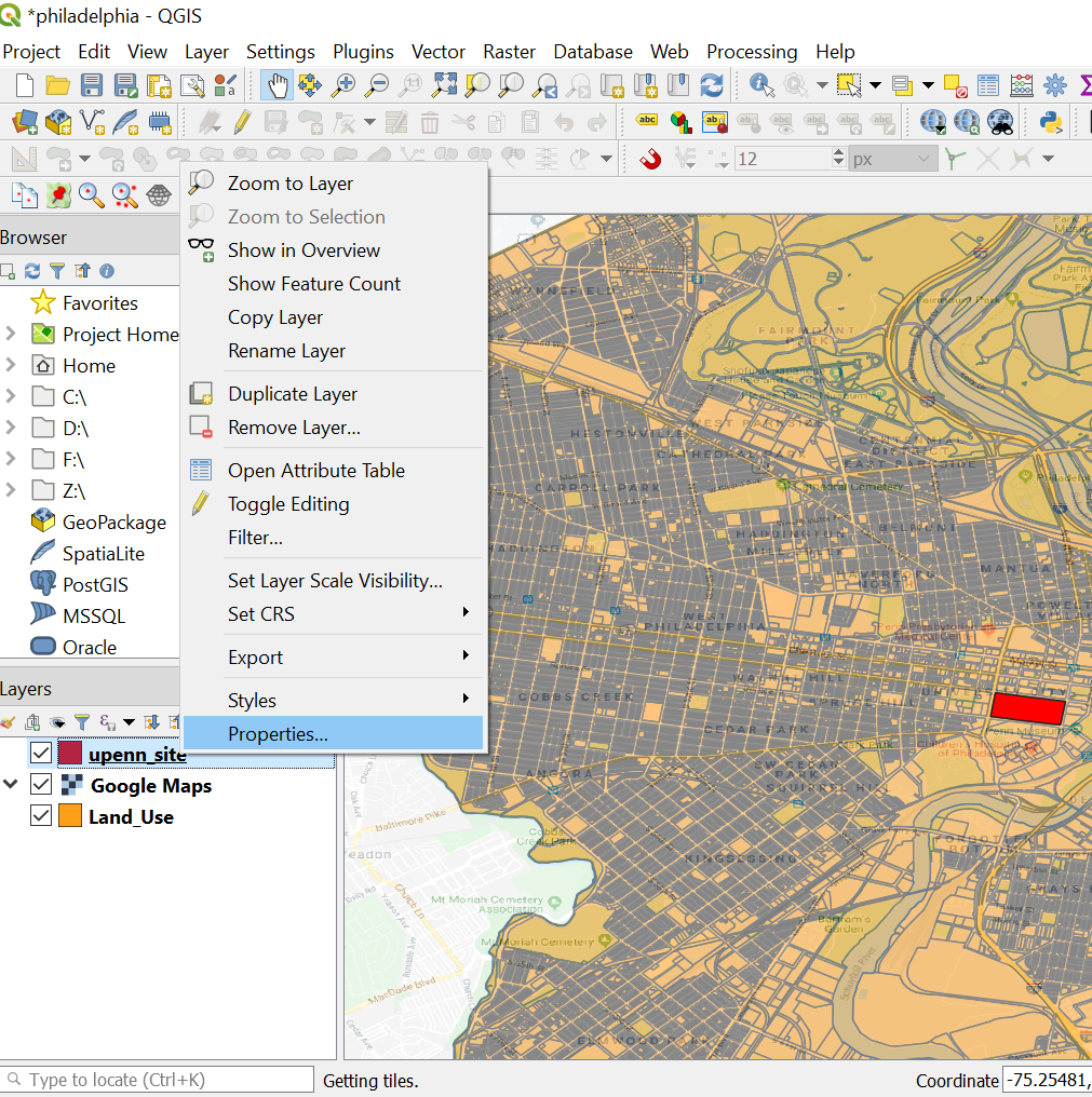
Let’s check what is the CRS system of our layers. Right click on the layer -> Properties …
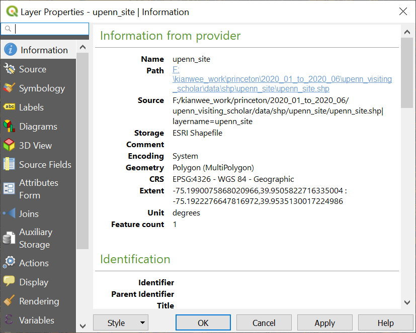
Go to the information tab. We can see that the CRS is EPSG:4326 and the Unit is in Degrees. So we need to project this onto metres.
Right click on the layer you want to reproject. Layer -> Export -> Save Feature As…

In the Save Vector Layer as… . In the Format parameter choose “ESRI Shapefile”. In the File Name parameter choose where to save your new projected layer.
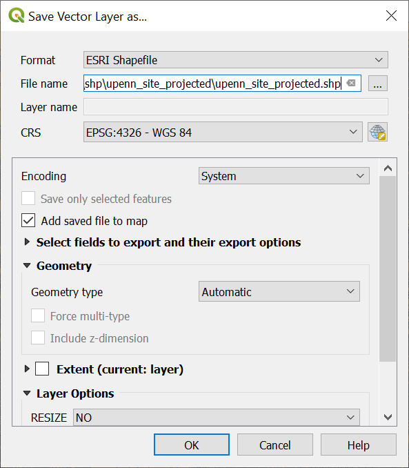
Click on the CRS symbol and search for 26918. Choose the “NAD83/UTM zone 18N” projection. We can see at the bottom left it give the detail of the projection, and the units is in metres. For more information in regards to which projection to choose read this blog entry.
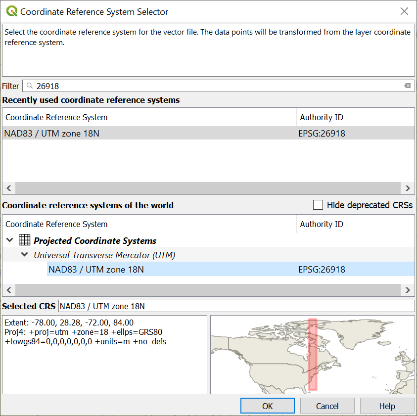
Click OK.

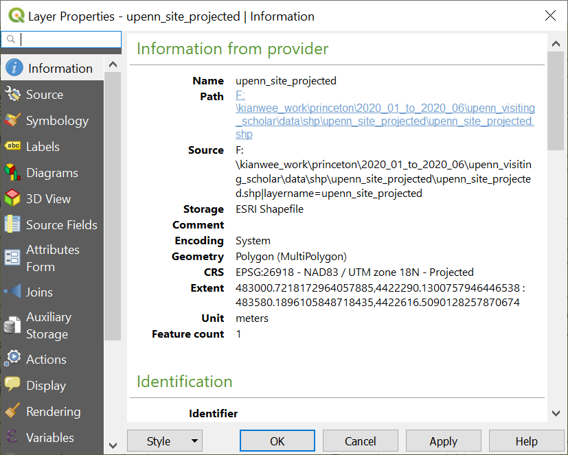
A new layer will appear on the layers window. Go the Properties of the layer and we can see that it has been reprojected into metres.
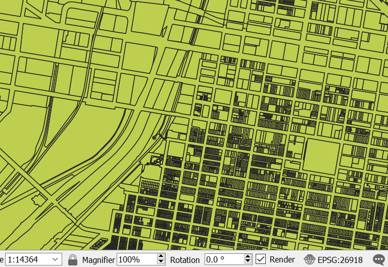
Lastly, since all our layers are using the same projections. Let’s set the project CRS to that layer. Right click on the layer. Layer -> Set CRS -> Set Project CRS from Layer.
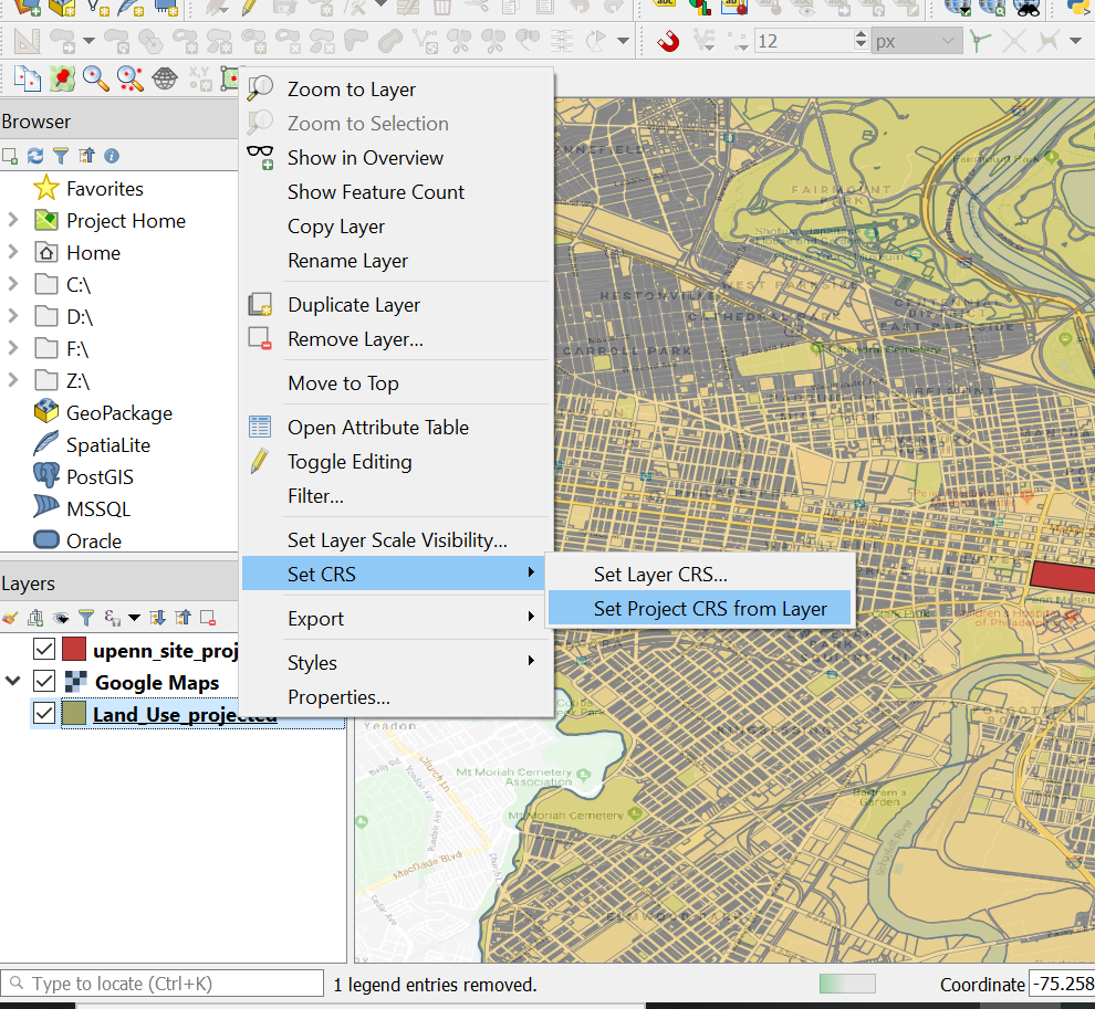
We can see that at the bottom right. The CRS has been changed to the layer CRS.