1.2. Projecting the Maps: From Lat/Lon to Metres#
In order to perform spatial analysis (intersection & unions) on the maps, we need to project it from Lat/Lon into metres. Refer to Understanding Coordinate Reference System/ Spatial Reference System used in GIS for explanation of Coordinate Reference System (CRS) and projections.
Reproject both the site and Land_Use layer (Reprojecting Files). The Land_Use layer will take longer as the layer has much more information.
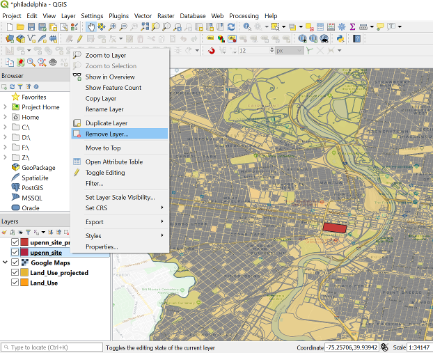
Delete the rest of the unprojected layer so that we do not get confused by so many layers. Right click on the layer, Layer -> Remove Layer …
Lastly, since all our layers are using the same projections. Let’s set the project CRS to that layer. Right click on the layer. Layer -> Set CRS -> Set Project CRS from Layer.
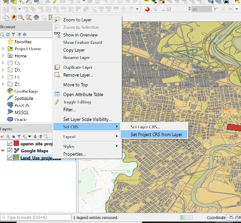
We can see that at the bottom right. The CRS has been changed to the layer CRS.